
Cheviots Forest Plan
About
The Cheviots Forest Plan combines the forests of Uswayford and Kidland. Both forests are located within the Cheviot Hills north of the village of Alwinton within the Northumberland National Park.
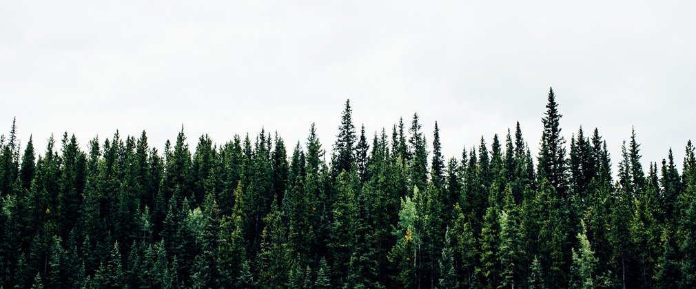
Uswayford extends to 862ha of which 611ha is managed as productive conifer plantation. The most common species is Sitka spruce and forest is approaching economic maturity. The forest, which is a red squirrel reserve, provides important habitat for red squirrels and is significant due to the close proximity to the neighbouring red squirrel reserve at Kidland Forest. Kidland Forest occupies approximately 2100ha of which 1181ha is managed by Forest Enterprise, the majority of the remainder being in a number of private ownerships. The forest comprises a mixture of spruce, pine and larch with Sitka spruce dominant.
Uswayford and Kidland Forests are designated as Red Squirrel Reserves and are located wholly within the Northumberland National Park. Both of the forests lie within the catchment of the River Coquet and its tributaries with the River Alwin, which is part of the River Coquet and Coquet Valley Woodlands SSSI, flowing from Kidland Forest.
Conservation interest in Kidland has been enhanced through forest restructuring. This has been achieved through forest planning, felling and restocking and open space management throughout the period of the previous plan and a variety of species of fauna and flora are represented in the forest. Despite the lack of forest restructuring localised conservation value in Uswayford is good. An ecological survey in 2015 identified 16 sites of conservation interest mainly associated with open ground along watercourses, the forest road and along the forest boundary. Kidland and Uswayford have been included in the suite of England Red Squirrel Reserves since 2001 due principally to their isolation, prevalence of small seeded tree species and lack of grey squirrels.
The soils in Kidland and Uswayford vary from peat generally on the flatter plateau areas to surface and peaty water gleys, rankers and upland brown earths. A soil survey in Uswayford (May 2016) identified the depth of peat soils (at randomly located points) throughout the forest and although overall the average growth rate of crops are good (indicated by Yield Class) the survey indicated that lower yield class crops (in the range 6 to 8) appear to be associated with limited areas of deeper peat. These areas provide potential for restoration to mixed habitats of a more open sporadic tree cover. Vegetation associated to these sample points indicates the presence of species representative of those on the adjacent undesignated open moorland; however, no species of significant interest associated to active blanket bog habitat were recorded. Carbon budget results (assessed in 2016) indicate that a long term sustainably managed forest is more effective at sequestrating carbon than that of the overlying peat soils.
One Scheduled Ancient Monument (SAM) is present within Kidland (Memmerkirk Chapel) which include the remains of a chapel dating from the 14th to 17th century. This site is well documented and covered by a management plan previously agreed with English Heritage. There are no SAM’s within Uswayford Forest. A number of non-scheduled sites exist within the plan area including boundary and standing stones along the eastern boundary of Uswayford and the north-east boundary of Kidland. The ancient drovers route of ‘Salters Road’ which passes through Uswayford is the name given to part of a route believed to have been used by salt traders during medieval period.
Kidland is dedicated under the CROW Act as open access with the exception of a small area and is regularly used by the local community for walking, cycling and horse riding with a good system of internal public rights of way linking to the wider countryside. In contrast Uswayford, although freehold, is not dedicated for open access due to reservations within the original conveyance at the time of acquisition; however, open areas of the forest were classified for open access land under the mountain, moor or heath mapping. Consequently access into Uswayford is restricted to public rights of way or access by ‘foot only’ across the open access land approaching the forest entrance. Uswayford, due to its remoteness is less visited and usually in association with walking excursions to the wider area including accessing The Pennine Way to Cheviot, Salters Road, Clennell Street.
Objectives
Our aim is to create a more diverse and resilient woodland, with a greater range of species and habitats. The objectives of management here are:
Economic
•Maximise the value of sustainable timber production by felling and restocking with productive mixtures and species best suited to the soils, and by thinning windfirm stands.
•Although Sitka spruce remains the principle commercial species for restocking wider species diversification will be introduced to improve resilience of the forest.
•Continued thinning of areas managed under continuous cover systems.
Environmental
•Management of Kidland and Uswayford as a single red squirrel reserve to increase robustness of future populations across both forests.
•Environmental and historical landscape enhancement will be delivered through forest restructuring achieved through forest planning, felling, and restocking and open space management.
•Protection of freshwater habitats, enhancement of riparian corridors and upper forest margin habitat creation
•Creation of open mixed broadleaved/ native William’s Cleugh Pine habitat
•Historic environment and archaeological features will be safeguarded during forest operations.
Social
•Species diversity and sympathetic management of external boundaries to enhance visual impact of the forest from public rights of way and the wider landscape.
•Maintain Public right of way network to a good standard and identify opportunities to enhance/improve visitor experience.
What we'll do
The proposals in this plan will lead to more diverse and resilient forests, with a greater range of species and habitats providing long term sustainability for the Red squirrel population. Substantial areas of native small seeded broadleaved woodland will have been established, and the range of conifer species will have been extended contributing toward greater resilience and diversity. Depending on the mix of objectives in the future, there will be a wider range of management options available. These will include a continuation of timber production from mixed stands but the presence of seed-bearing broadleaves will also offer the possibility of further extension of the native woodland resource through natural regeneration.
The current plan outlines management proposals including felling and restocking over several decades, with felling licence approval for operations up until 2027.
For further information regarding species composition and the future management of Cheviots, please refer to the full plan below.