
Haywood and Castiard Vale Forest Plan
About
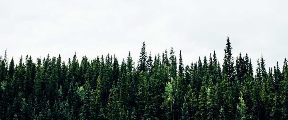
The Haywood and Castiard Vale Forest Plan covers 840 hectares of broadleaved, coniferous and mixed woodland and open habitat located on the eastern side of the Forest of Dean in Gloucestershire. The area comprises Haywood and Edgehills, together with the woodlands that make up Castiard Vale, namely Flaxley Wood, Welshbury Wood and Chestnuts Wood. Of this area, all of which is freehold, 550 hectares are within the statutory Forest of Dean boundary, with Flaxley and Welshbury Woods lying just outside.
The town of Cinderford lies to the south of Haywood, the biggest woodland block in the plan, and there are several other villages and hamlets within the area. All of the woodlands are used for informal access and recreation, and there are a number of public rights of way, together with numerous informal paths and tracks within each woodland.
The landscape here is characterised by a network of ridges and valleys, and the woodlands are prominent features within it. There are many features of ecological, historical and geological importance, all of which have implications for management decisions:
•Within Haywood are two SSSIs – Westbury Brook, an old iron mine, which is a significant hibernaculum for horseshoe bats, and Edgehills Quarry;
•Also within Haywood are areas with potential for the restoration of lowland heath – a rare resource in Gloucestershire; in neighbouring Edgehills is a lowland heath reserve managed by Gloucestershire Wildlife Trust;
•Welshbury Wood is dominated by an iron age hill fort, which is designated as a Scheduled Ancient Monument (SAM), and an underlying bronze age field system, parts of which are also designated;
•St Anthony’s Well, which may have been associated with Flaxley Abbey, is one of the most picturesque holy wells in the county;
Various rare and protected species are found within the woodlands, including dormice and nightjar.
Much of the area is designated as ancient replanted woodland, and includes veteran trees, coppice woodland, unimproved grassland, and many different tree species, including oak, ash, small-leaved lime, sweet chestnut and several species of conifer.
Objectives
Our aim is to safeguard and develop the unique and individual ‘sense of place’ that each woodland enjoys, working with consideration for landscape, ecology and geology, while diversifying the species age and structure, leading to a more robust and resilient forest in the future. The objectives of management in this plan period are:
Environmental
•To restore ancient woodland and to protect areas of native broadleaved woodland – veteran trees will be protected, and standing and fallen deadwood will be retained; there will be a modest increase in broadleaves over the plan period.
•To undertake management that protects and enhances woodland and open habitats – the sustainable programme of thinning and felling, with a varied restock programme, will enable better resilience and adaptation to future threats such as climate change, pests and diseases.
•To conserve the ecological features and geological exposures associated with the two SSSIs, maintaining these in favourable condition, in line with their specific management plans.
Social
•To enhance and conserve the natural beauty and character of the landscape – taking into consideration the mid- to long-distance views of the woodlands, and their importance to local people and visitors.
•To conserve cultural and heritage features within the plan area, notably Welshbury Hill Fort and St Anthony’s Well, but also including ongoing monitoring and consideration of unscheduled features when planning forest operations.
•To maintain the area for the benefit of informal recreation.
Economic
•To manage the woodland to UKWAS standards, with continued production of marketable woodland products – growing quality timber in so far as this is consistent with other management objectives.
What we'll do
The current plan outlines management proposals including felling and restocking over several decades, with felling licence approval for operations up until 2024.
The planned areas of clearfelling and restocking during the ten years to 2024 are shown below.
Clearfelling of 36ha of conifers and 11ha of broadleaves. Restocking/regeneration of 9ha of conifers and 20ha of broadleaves. Retention of 18ha of open space.
In addition to these defined operations, ongoing thinning and selective felling of both conifers and broadleaves will be carried out in the plan area at five to ten year intervals.
The species composition will also change from 36% conifer, 46% broadleaf, 5% felled area and 13% heath/open space in 2014 to 34% conifer, 50% broadleaf, 3% felled area and 13% heath/open space in 2024.